
Charting new territories
We just got back from Portugal. And if you read last week’s article, none of my fears materialized.
Instead, Paul and I enjoyed exploring Porto and Lisbon and learning more about Portuguese history and culture, and gained fresh perspective to resume our daily lives in Washington.
The Portuguese are famed for pioneering navigational and maritime methods at the end of the Middle Ages and reaching new and seemingly impossible destinations, navigating the Atlantic in their search for India.
Prior to this, sailors stayed close to the shores of the Mediterranean and didn’t travel long distances, much less venture into the Atlantic Ocean.
Prince Henry the Navigator commissioned a new type of ship that would sail upwind. The caravel, in and of itself, was a breakthrough in sailing. It was smaller and used triangular sails that could sail into the wind.
In 1497, Vasco de Gama set sail, and nearly a year later, reached the shores of India and opened up a prosperous trade route.
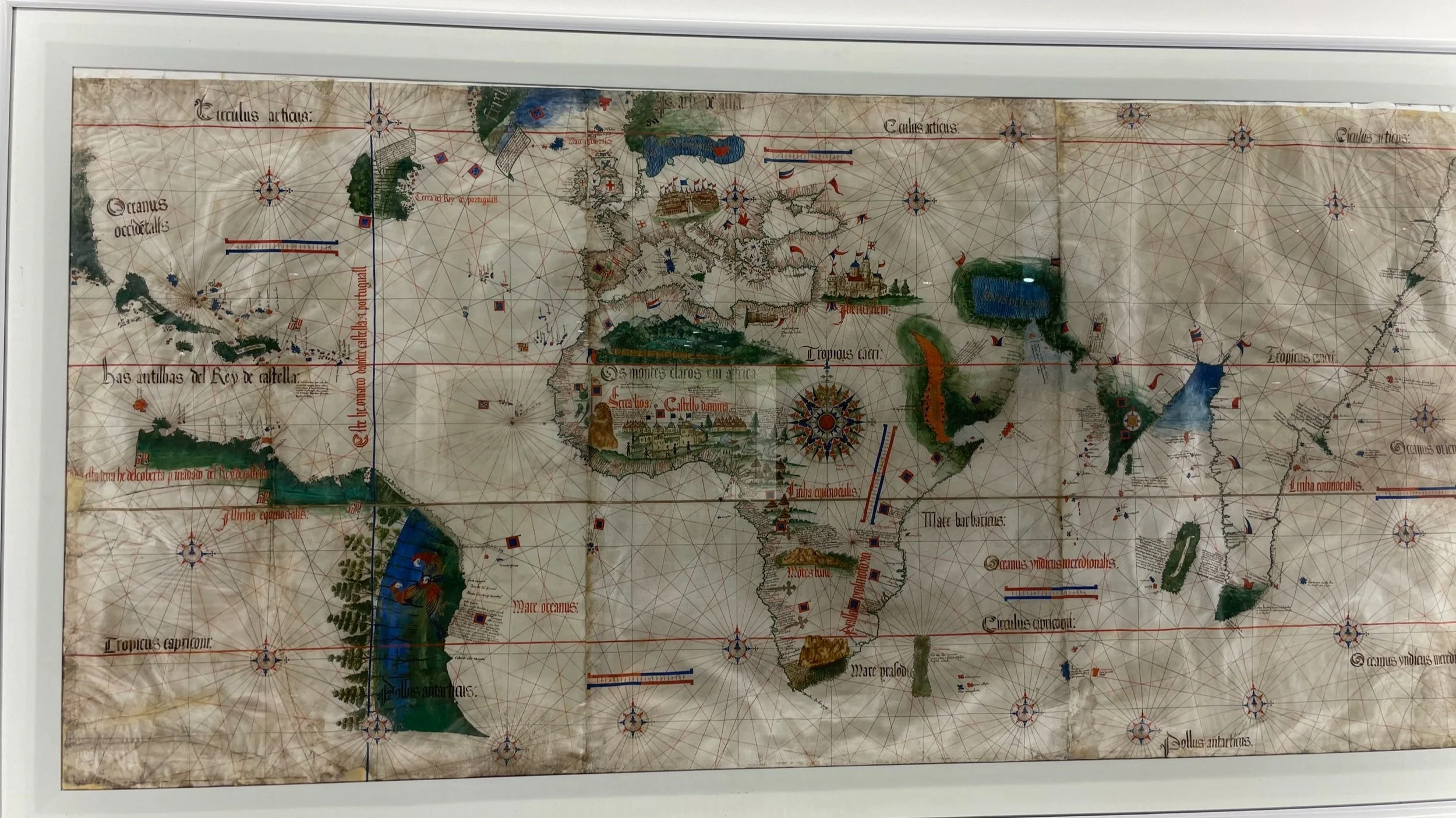
Photo by Audrey Donnell, Anonymous World Map from 1502, Maritime Museum, Lisbon
With each expedition, the sailors learned from their experiments and invented new tools that would help them reach their goals.
One Portuguese invention was modifying the planispheric astrolabe that astronomers had used since Classical antiquity. The Portuguese mariner’s astrolabe was used to measure the angle between the vertical of the observer and the position of the sun at solar noon. With additional calculations, it enabled the determination of the latitude, which helped the sailors identify the position of their ship at sea. This was the 15th century equivalent to GPS in the late 20th century.
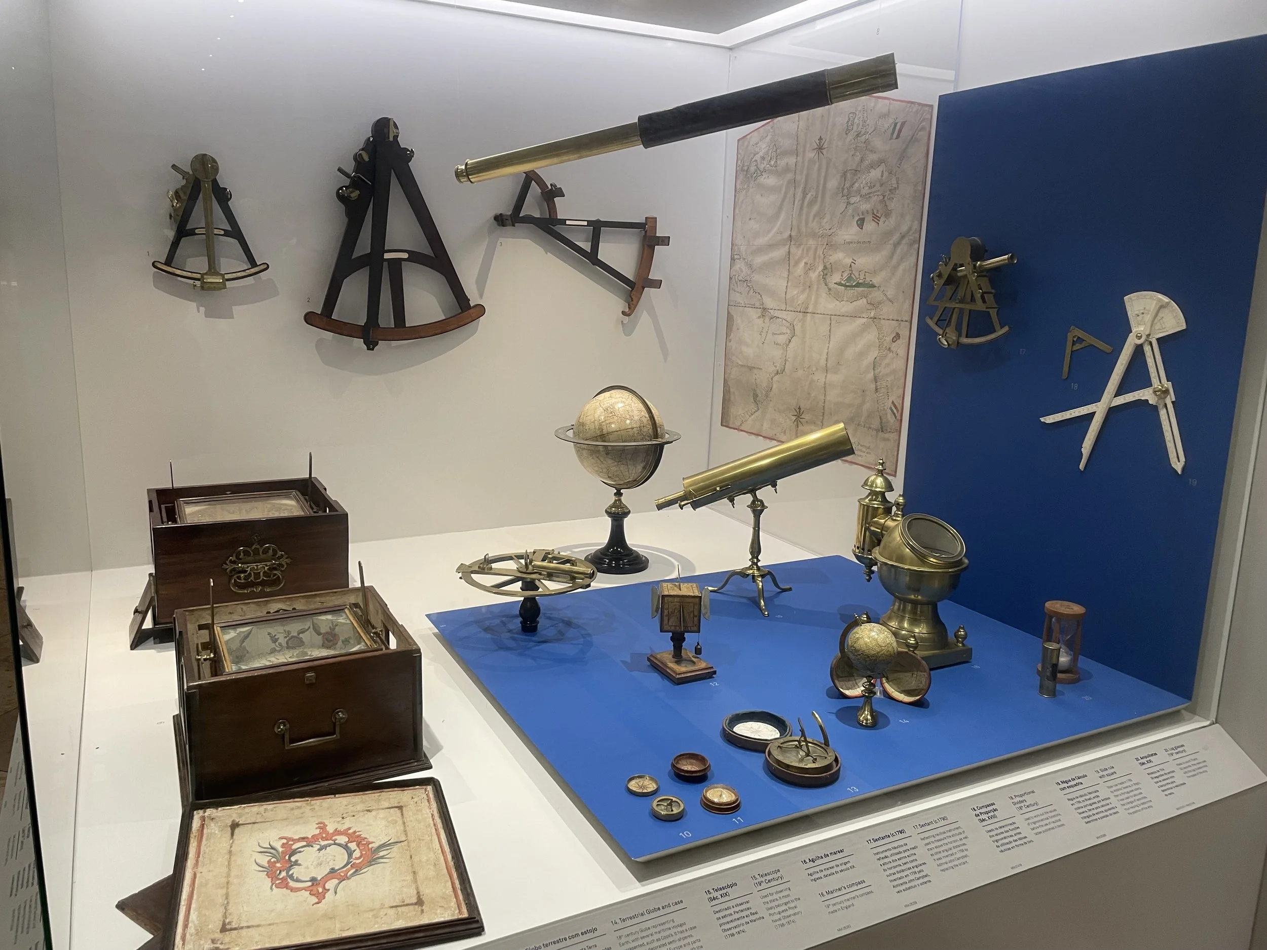
Photo by Audrey Donnell, Maritime Museum, Lisbon
I took this picture at the Maritime Museum in Lisbon. I love it because it showcases some of the tools the Portuguese sailors and cartographers relied on for their nautical breakthroughs.
You might recognize the telescope, globe, compass, and proportional divider (used by cartographers).
These early explorers could not have made their discoveries were it not for these tools to map their location, chart their course, and push the envelope of what was known.
They were venturing completely into the unknown.
It puts in perspective our lives, business, and leadership, when you consider that we too are navigating the unknown, and charting our way through uncertain waters.
If we’re completely honest, the future is uncertain. We like to think that we have certain control, but ultimately, life is one big uncertainty.
The early explorers navigated uncertainty with tools that were reliable and trustworthy, or they invented the tools they needed. They knew they could determine their location using the stars and the sun. And they could document it by drawing up the first maps.
But the maps only reflected where they had been. They couldn’t show them the way. At least on their first voyage.
This gives us an important distinction in life. Roadmaps aren’t useful except to show where you’ve been, or maybe to travel a known route. If you want to chart new territory, you need a compass.
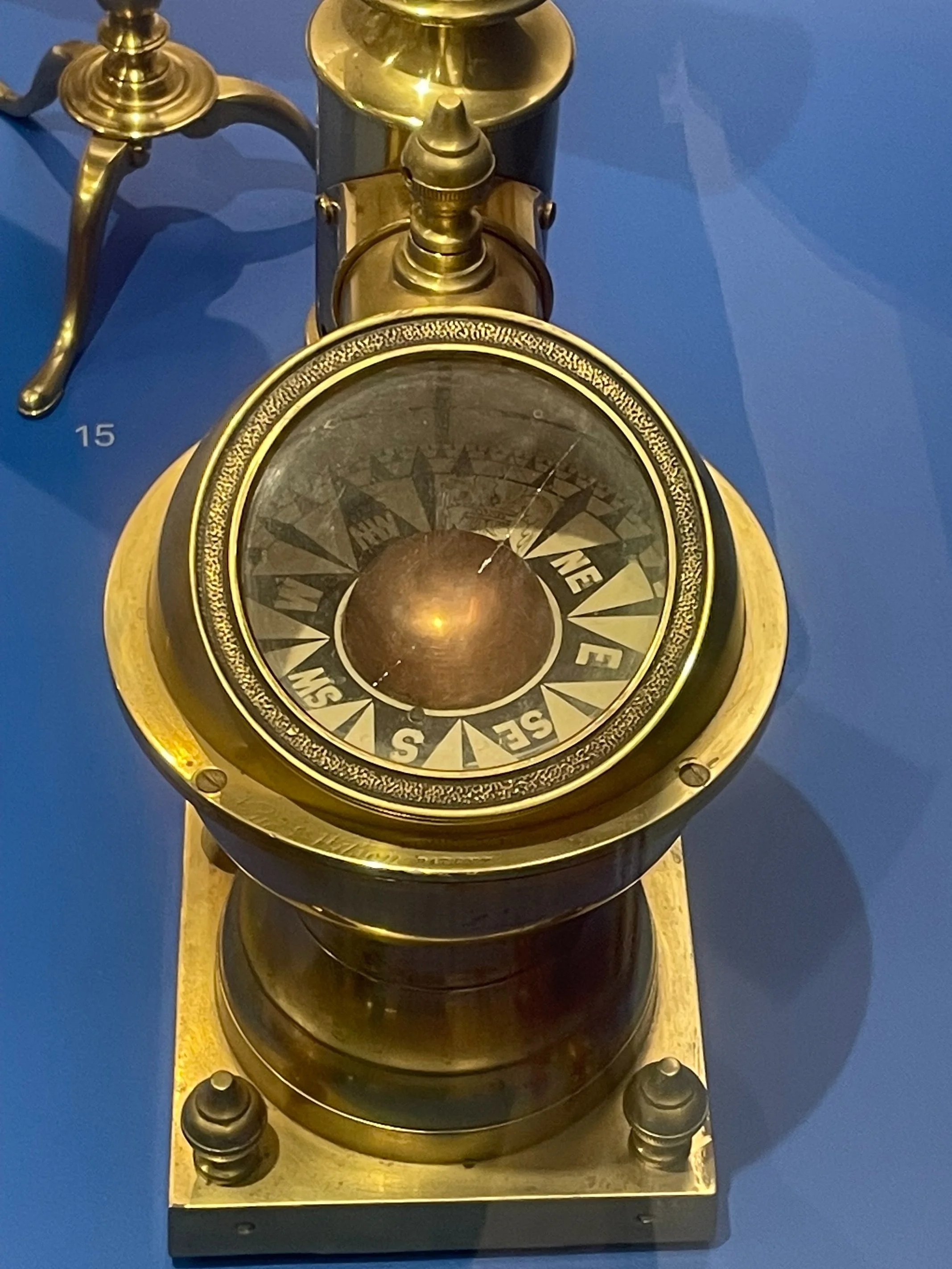
Photo by Audrey Donnell, 19th century mariner’s compass, Maritime Museum, Lisbon
What is your compass? What helps you know what your true north is?
When you consider where you’ve been and what’s ahead, what tools do you need to invent to help you along the way?
When charting new territories in your own life, you are the explorer. You are the navigator.
How good are your tools for navigation? What would make them better?
Love,
Audrey